Sunday, June 16, 2013

Green Chile Count

I arrived Tuesday, June 11 around 9am. I went to a "tea" with Mother but there were no green chiles served there. Mother made my favorite beef strogonoff for dinner (no green chiles). Wednesday morning (and Friday morning), I had a green chile cheese bagel at Smith's grocery store in the deli department with my parents and their walking group.


Wednesday was a stay at home day and enjoy casual time with my parents. No green chiles in their house. ;-) I did go out to get my hair cut and enjoyed time at Pen 'n Pad, a great little shop I've enjoyed since childhood. I came home with refills for two favorite pens plus two new calligraphy pens and a cool notebook I can use in my new job as division chair.

Thursday, Mother and I went to "Fun Day" and toured Lilly Barrack's jewelry studio then to lunch at St. Clair Winery and Bistro where I had Pasta New Mexico--pasta with Southwestern cream sauce and green chiles. The menu special was a glass of their Blue Teal Riesling for $4. Oooooh yummy wine and great pairing.


Friday was another stay at home day.

Saturday morning when "the gang" went to brunch at Milly's (as they do every Saturday), I had Milly's Breakfast Special of potatoes smothered in red or green chile (guess which I had), cheese, sausage, bacon, and ham, topped with two eggs any style (I chose "over easy"), served with a flour tortilla. This is not a photo I took (why would I order coffee?? and pancakes and orange juice?? I couldn't finish the breakfast by itself), but that came from their website. I guess I was too excited to eat Milly's breakfast, plus having so much fun visiting with longtime family friend Stephanie, that I forgot to take a pic.


Saturday night, before seeing The Producers at Albuquerque Little Theatre, we had dinner at Route 66 Diner, where I had a root beer float and green chile stew.


Sunday was Father's Day and while Mother attended a surprise birthday party for a friend of hers, I took Daddy out to lunch. He said he didn't really care where we went as long as there was ice cream. The Model Pharmacy (one of our favorites) was closed on Sundays so we did a little yellow pages search and then a Google search and found Route 66 Malt Shop (not to be confused with the 66 Diner). Dawn was our waitress and we had a blast, plus it was yummy yummy yummy. I had a quesadilla with 2 cheese, tomato and green chile. Oh my. Daddy had a barbecue sandwich and we both had banana hot fudge sundaes for dessert. (We both brought home boxes with half of our lunch so we could have plenty of room for the sundaes...I'll get to have more green chile quesadillas later.)

Thursday, May 23, 2013

Surprise! Capitol Reef National Park

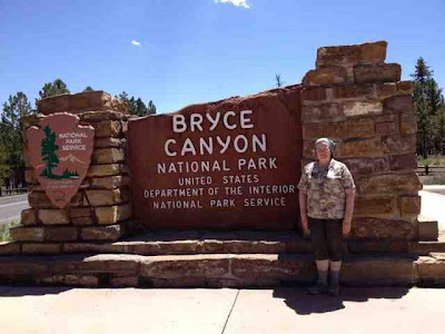
We drove out of Bryce on State Road 63 and had to decide which way to go back to Grand Junction. To the left on 12-West would take us back to the Interstate via the route that we took getting to Zion. Been there, done that, let's try something else. We got about 100 feet on 22-North when Rodney said, "I don't like this. It doesn't feel right. Let's take something more scenic." I didn't tell him how much longer it was, I just said, "12-East goes to Hanksville and we know we can get from Hanksville to the Interstate because we saw those signs when we first went from Arches to Zion." Okay, that's the way we're going.

You'll remember from the first entry in this series that I had seen this t-shirt in the gift shop at Bryce. We had now been to 4 out of 5 of the parks on the shirt. Pretty cool. We'd never heard of Capitol Reef and couldn't imagine that it offered anything different than we'd already seen in the other four parks. (Surely we would've heard of it it had anything special going on.) But out of curiosity, I looked it up on the map. It was between Bryce and Canyonlands but seemed impossible to get to. It looked like it would take us more than 2 hours out of our way on the 5-hour drive home (now 6-hour drive since we added this scenic route).

So imagine our surprise when we saw this sign!!

Well, maybe we were driving through the park, but according to the map, we weren't going anywhere near the official entrance to the park.

Wrong again. Next stop: Visitor's Center. We picked up the NPS map/brochure of the park and knew we had found a hidden gem. Oh were we ever glad that we took the alternate "scenic route"! 

According to the National Park Service website, "Located in south-central Utah in the heart of red rock country, Capitol Reef National Park is a hidden treasure filled with cliffs, canyons, domes and bridges in the Waterpocket Fold, a geologic monocline (a wrinkle on the earth) extending almost 100 miles."

As beautiful as the park was, the history was equally compelling. "The area of Capitol Reef has been a homeland to people for thousands of years. Archaic hunters and gatherers migrated through the canyons. Fremont Culture solidified around 500 CE, from food foraging groups, to farmers of corn, beans and squash. Petroglyphs etched in rock walls and painted pictographs remain as sacred remnants of the ancient Indians' saga. Explorers, Mormon pioneers and others arrived in the 1800s, settling in what is now the Fruita Rural Historic District. They planted and nurtured orchards of apples, pears, and peaches."

We missed the petroglyphs (guess we're heading back some day) but found the historical buildings and lush orchards fascinating. My favorite part of the whole heritage of the place: "Mormon pioneers planted the historic Fruita orchards beginning in the 1880s. The orchards are managed to preserve their historic character and are watered with an irrigation system essentially in original condition. Visitors can pick and eat fruit in the orchards in season and purchase fruit and nuts to take along."


There is a campground nestled in this canyon valley that was so tranquil and picturesque. Yet another reason to come back.

We drove the aptly named Scenic Drive, an 8-mile road (16 miles round trip) that goes past some great formations. The colors of the stone in this park were different from the other four.


Leaving Zion--Fairyland

We left Bryce around noon with a stop in Fairyland...another scenic lookout. It's just kinda "more of the same" but it was one last look at the unique beauty of Bryce Canyon.


Ron Chapman, my favorite DJ in Dallas, used to say, "There's never a sign without a story." This sign makes you wonder.


Bryce--Sunrise

We got up extra early and left our cabin by 5:45 to try to get to a good sunrise photo. We started at Inspiration Point, which was recommended by our waitress last night, but when we arrived there wasn't a single car in the parking lot. We were pretty sure that wasn't a good sign. So we went to Bryce Point and saw lots of cars. Arriving at the point, we found plenty of people. More "paparazzi."
It was worth the early rise and the windy wait. Pictures cannot capture how incredible the first morning light is on these rocky hoodoo formations. It was exquisite.


We headed back to the cabin and then walked to Sunrise Point which is soooo close to our cabin. Staying in these cabins is the way to see this park! You don't have to fight all the tourists and the shuttle buses; everything is right out your door. So there's a Sunrise Point and a Sunset Point that are at most half a mile apart and the cabins are smack dab in between them. You'd think it would be a great place to see sunrise or sunset but apparently not. But it is the place to start the famous 3 mile loop that goes down into the canyon, through the hoodoos, and back up.


I let Rodney take this hike solo. I've been slowing him down, I'm certain--especially on the uphill climbs. And I had some work I needed to do. So I walked to the trail head with him and then we split ways. I couldn't wait to see his photos. It was like being there (but without the hike). ;-)


Wednesday, May 22, 2013

Bryce--Evening Drive and Dinner at the Lodge

After checking in to our cabin, we headed to the visitor's center to plan our strategy for our short stay in Bryce. We decided to do the drive along the rim, then dinner in the lodge, then possibly a moonlit walk on the rim hiking trail outside the cabins. The park encompasses a 19-mile long stretch of canyon. The road sits on the rim of that canyon and only has turnouts/lookouts on the rim-side of the road. It's highly recommended that you drive to the end of the road, then stop at the lookouts on the way back where they will always be on the right side of the road. 

Sounds good. Lets go! The first point is Rainbow Point. Altitude 9,115 feet?! Eeegads we are high up!

At the first few stops, we were just looking at pretty canyons. We've seen pretty canyons. We started skipping lookouts or doing the 30-second run-and-look routine. But then we hit Bryce Lookout and that was all she wrote. These hoodoo things are impressive, and they're made out of the same thing as the arches and canyons we've already seen: Navaho sandstone and water over time. How can all these places be so close, have the same makeup, and yet each look so uniquely different and beautiful?


Bonus! Animal on the side of the road!


And then we had dinner in the lodge. At first it looked like it was going to be overpriced and overrated but we had a great server and the half-portions were plentiful and economical. I had elk chili! Quite yummy.


Bryce--Our Cabin


We arrived at Bryce around 2 in the afternoon. Check-in time isn't until 4:00, but we stopped at the front desk and asked about early check in. Lucky us--housekeeping had already cleaned our cabin and it was ready. Yay! An extra 2 hours or so in our cabin. The lodge and cabins at Bryce were built in the 1920's. Unlike Yellowstone's big lodge or some of the other national park lodges, the lodge here is rather small and serves as a central location with a dining room, gift shop, "concierge," etc. The lodging itself is in cabins. There are duplex and quadplex cabins. They still have their quaint 1920's feel but have definitely been modernized for today's "campers" like us.


I love the 1920's tile in here but everything else is modern.


This is the entrance to 511, our cabin. You can't really tell that there are 3 other cabins connected to it. This photo does not capture the unusual roof lines that have a slight curve to them and an interesting curvature in the shingles as well. Next time we come, we're asking for a duplex instead of a quadplex...they appear (from the outside) to have a higher ceiling as we could see another triangular window above the big picture window. And of course, less chance for noisy neighbors. But the front desk assured us the floor pans were exactly the same in all the cabins and we had absolutely no complaints about ours.

Between Bryce and Zion

We saw this place twice. Rodney knew we were gonna have to stop the second time we saw it. Gotta love a rock shop in a place called The Rock Stop that's shaped like a rock. Rock on!

(Okay, the reality is that now just the touristy things are in this building and the rocks are in the building across the street...close enough.)


Zion Day 3--Canyon Overlook Hike


From ZionNational-Park.com: "The Canyon Overlook Trail is one of Zion's classics that is well advertised by the park. The trailhead is located immediately east of the 1.1 mile long tunnel. It begins with charming steps, carved into sandstone, that climb above the Zion-Mt. Carmel Tunnel. The winding trail travels along Pine Creek Canyon, a popular canyoneering route and the Zion-Mt. Carmel Tunnel. It is a short and easy hike ending at the edge of a cliff that allows a glorious view of lower Zion Canyon, including Zion's famous Switchbacks, the Beehives, West Temple, East Temple, Towers of the Virgin and the Streaked Wall. If you are looking for a high elevation viewpoint, but do not want to tackle a grueling trail like Observation Point, then the Canyon Overlook Trail is ideal. There are lots of hoodoos and wild flowers along the trail that make it fun for kids but keep your children close to you and safe while hiking in Zion." That pretty much describes it though at the time we didn't know what a hoodoo was.
Distance: 1-mile round-trip
Average Hiking Time: 1 hour round-trip
Difficulty: Easy for most adults, moderate for young kids.  There are some exposed cliffs.
Sun Exposure: Full sun in most places.
Elevation Gain: 163', which is a moderately, easy climb after the initial elevation.
Peak: 5300'
Trail Conditions: Expect a well maintained path that is mostly sandstone with some packed dirt sections. This hike is tolerable during the hottest parts of a summer day, but it is best enjoyed in the morning or late evenings that time of year. Sand or moisture on the trail may make it slippery. Do not hike this trail if it is wet, raining or lightening.

The sign at the trailhead:


Here we are inside a cave/opening looking out. The trail went right by the front of this opening.

At the top:


The sign telling us what we were looking at:

After this hike, we stopped at a scenic overlook, fixed some sandwiches for lunch, and ate in the car enjoying fresh air and beautiful scenery through the windows.


Tuesday, May 21, 2013

Zion Day 2--Hiking the Narrows

On National Geographic's list of America's Top 100 Adventures is to hike The Narrows at Zion. There are two ways to do it...from the "top" take the 16-mile hike that requires a permit or "from the bottom" and just venture up as far as you want to and go back to where you started. National Geographic is probably referencing the first approach since their list is fairly extreme and includes heli-skiing, surfing, climbing, biking, and paddling. But the second approach from the bottom is still incredible and that's the one we took.

National Geographic describes it beautifully. The canyon "winds voluptuously through the crimson sandstone, in some spots stretching 2,000 feet (610 meters) high and narrowing to 20 feet (6 meters). Lush hanging gardens spring from the walls, stately ponderosa pines grow in nooks, and the water can turn a shade of turquoise that perfectly contrasts with the cliffs’ deep terra-cotta hues. The hike isn’t necessarily a cakewalk, however: For more than half the time, hikers walk in the Virgin River, which can be waist-high, and negotiate cobbles as large and slippery as bowling balls."

We took the shuttle from its first stop (the Visitor's Center right by our campground) to its last stop, Temple of Sinawava--about a 45-minute ride. From there you walk the mile-long Riverside Walk, a paved walkway that goes alongside the Virgin River. At the end of Riverside Walk is a place where you can start your wading in the river.

I forgot to bring my new hiking poles. After about three steps in the water, I knew that was a mistake. Almost immediately, a nice young man walking towards me, who was obviously just finishing his journey through the narrows, offered me his walking stick. "You'll need it," he said. The nice young woman who was walking with him offered hers to Rodney. Oh goodness! He was so right! Did I ever use that walking stick!! A couple of times, I got to thinking that I probably would've bent my hiking poles and this big stick was a much better solution.


There is no set path to follow. You look at hikers ahead of you and decide if you want to go that same route or not. At least a third of the time, there was no choice but to wade in the water as the river went from canyon wall to canyon wall. But sometimes there was a little shore line to walk on and sometimes you crossed the river to get to another shore line on the other side.


After about an hour and a half, I could feel my energy draining and I knew no matter how far in we hiked, that was exactly how far we had to hike back out. So we found this nice rock and I soaked up sunshine and enjoyed the beauty of The Narrows while resting. Meanwhile, Rodney hiked further up the river, then came back and picked me up and we made the return trip together.


At the end of the trip, I was looking for someone to pass my hiking stick on to, but there weren't many people starting their adventure that late in the day. We did, however, at the end, see a collection of walking sticks leaning up against a ledge, so we put our sticks in the collection for tomorrow's adventurers.

Though paved and pretty level, I think the mile hike on dry land on Riverside Walk back to the shuttle was the hardest part of the trip LOL.


It was definitely a grand adventure to add to the bucket list. (Who knew to put it on there in the first place?) And now I can cross it off. Would I do it again? You betcha!


Zion Day 2--A New Campsite

When we made our reservations 6 weeks ago, there were very few campsites left anywhere in the park. We were lucky to get what we got, which didn't happen to be the same site two nights in a row. :-( So here's a test of your camping patience: set up your tent, sleep in it, take it down, move less than half a mile away, set up your tent again but this time on a rockier surface than the last site, and still have time to enjoy the day. We passed the test. The site we had reserved was pretty bleak, but we went back to the ranger station and they were able to swap us out for a better one. See the shade? That's part of why we picked this one (that and proximity to the bathroom plus the view). Unfortunately, the shade only was there in the morning. We definitely liked our first night's campsite better but this one ain't bad. And check out our view...no matter which way you look.


We ate an early lunch in our campsite before heading out. Here's another "lunch with a view."